

Monitoring
Tier 1 Data Sheet
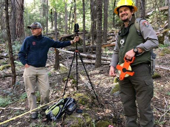
The Tier 1 protocol requires the use of a 10-factor prism to collect basal area data and a single terrestrial lidar scan.

Tier 2 Data Sheet
The Tier 2 plot were created with traditional monitoring in mind. These involve taking a scan at plot center, collecting transect data, overstory data including the tree species and how many is recorded as well as using a ten-factor prism to obtain basal area. The purpose of these techniques is to link the lidar data to traditional fuel metrics. This data is necessary to develop linear models which determine that relationship between this physical data and those values reported from the point cloud analysis.
Included on this page are data sheets developed for use in the Southeast and the Southwest. These can be modified depending on the needs of the location.
But once initial baseline plots are established, only Tier 1s will be required.

Downloadable Files
Methods Manual:
To decide which template to download, start by looking where you fall in the ecoregions map below. Tier 2 plots are the ones that vary the most between ecoregions. These regions are only an approximation. If you feel your fuel type more closely matches another ecoregion, download that relevant regions’ template and reference guide.
Below are Surveys that were created for various ecological areas of the United States. Each have the excel file along with a pdf to explain how to customize the survey.
Mixed Forest: Inland Southeast US and Outer Coastal Plain Mixed Forest: Southeast US:
Subtropical/Tropical: Southwestern US: