



Accurate and comprehensive field records are the foundation
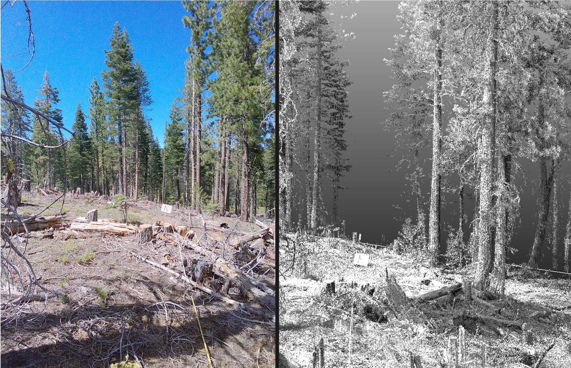
Land managers and practitioners rely on accurate and relevant records of current field conditions, so that change over time can be measured. This information serves as a foundation for making informed land management decisions. Monitoring data are essential for evaluating forestry practices, assessing fuels, and understanding ecological changes—whether these are driven by natural processes or management interventions. Often, data gathered through monitoring are extrapolated to determine management success or to identify future needs. An effective monitoring program ensures that the data collected are sufficient to detect changes and guide decisions for adaptive management.
Limitations of Traditional Monitoring Methods
Conventional ecological and wildland fuels monitoring techniques—such as distance measurements, line intercepts, and quadrat sampling—require substantial setup and specialized expertise. Each method is typically designed to assess only one aspect of an ecological condition, so multiple methods are often necessary to capture factors of interest like groundcover vegetation diversity, forest structure, and wildland fuels. Additionally, traditional methods can be time consuming and prone to data collection and data entry errors.
Who are we?
The Terrestrial Lidar Monitoring Project is an interdisciplinary team of collaborators from federal agencies, academia, and the New Mexico Consortium. This diverse group combines their skills and perspectives to address the challenges of monitoring and managing natural resources through advanced technologies.
Research Group
- Dr. Michael R. Gallagher – USDA Forest Service, Northern Research Station, Climate, Fire, and Carbon Cycle Sciences
- Dr. E. Louise Loudermilk – USDA Forest Service, Center for Forest Disturbance Science, Southern Research Station
- Dr. Aaron Maxwell – West Virginia University, Department of Geology and Geography
- Dr. Nicholas Skowronski – USDA Forest Service, Northern Research Station, Climate, Fire, and Carbon Cycle Sciences
Operations Group
- Chad Anderson -Resource Management, Redwood National Park, National Park Service
- Leta Douglas - U.S. Wildland Fire Service, Southeast Region
- J. Mark Jackson - Fuels Management, Bureau of Indian Affairs
- Laila Lienesch - New Mexico Consortium, Center for Applied Fire and Ecosystem Science
- Emily Link - U.S. Wildland Fire Service, Southeast Region
- Dr. Seth M. Munson - U.S. Geological Survey, Southwest Biological Science Center
- Scott Pokswinski - New Mexico Consortium, Center for Applied Fire and Ecosystem Science
- Dr. Andrew J. Sánchez Meador - Northern Arizona University, Ecological Restoration Institute
- Dr. Grant Snitker - Utah State University, Anthropology Program
- Jon Wallace - North Florida Refuge Complex, U.S. Fish and Wildlife Service
- Brett Williams - USDA Forest Service, Center for Forest Disturbance Science, Southern Research Station
Training
- Tim Yurkiewicz – USDA Forest Service, National Interagency Prescribed Fire Training Center